|
|
|
Objectives and Agenda (tentative)
|
|
|
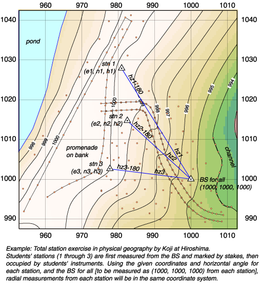
Objectives 1. To understand the principles of total station survey. Don't make total station survey a black box. If one understands the principles, technical details of machine operation, data processing, and map drawing will never be a magic. 2. To understand survey strategy for geology and geomorphology. How to measure 3D topography, and 2D polygons, linear features, and profiles in good order, with desired resolution, in readiness for computer-aided map drawing, and without loosing accuracy. 3. To process and present the data in the most effective way. Microsoft Excel (and/or text editor, sed, and awk) for data arrangement and adjustment. GMT for scaled plotting, DEM generation for contours, tints, and shaded relief, and EPS output for extensive uses in PC & Mac. Adobe Illustrator for details and artistic touch. Again, no black box. |
|
|
|
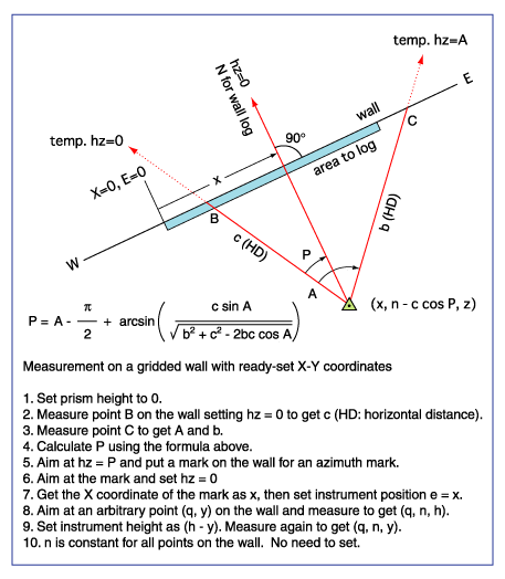
Plan for the survey 3. Wall mapping (11:00--13:30 including lunch break: outside a building)
Mapping an exposure with grid lines 4. Data retrieval (13:30--14:00 lecture room) |
|
|
| to Koji's Digital Mapping Page |
|
|
|
|

