Buoy deployment in Mitsuguchi Bay, Yasuura
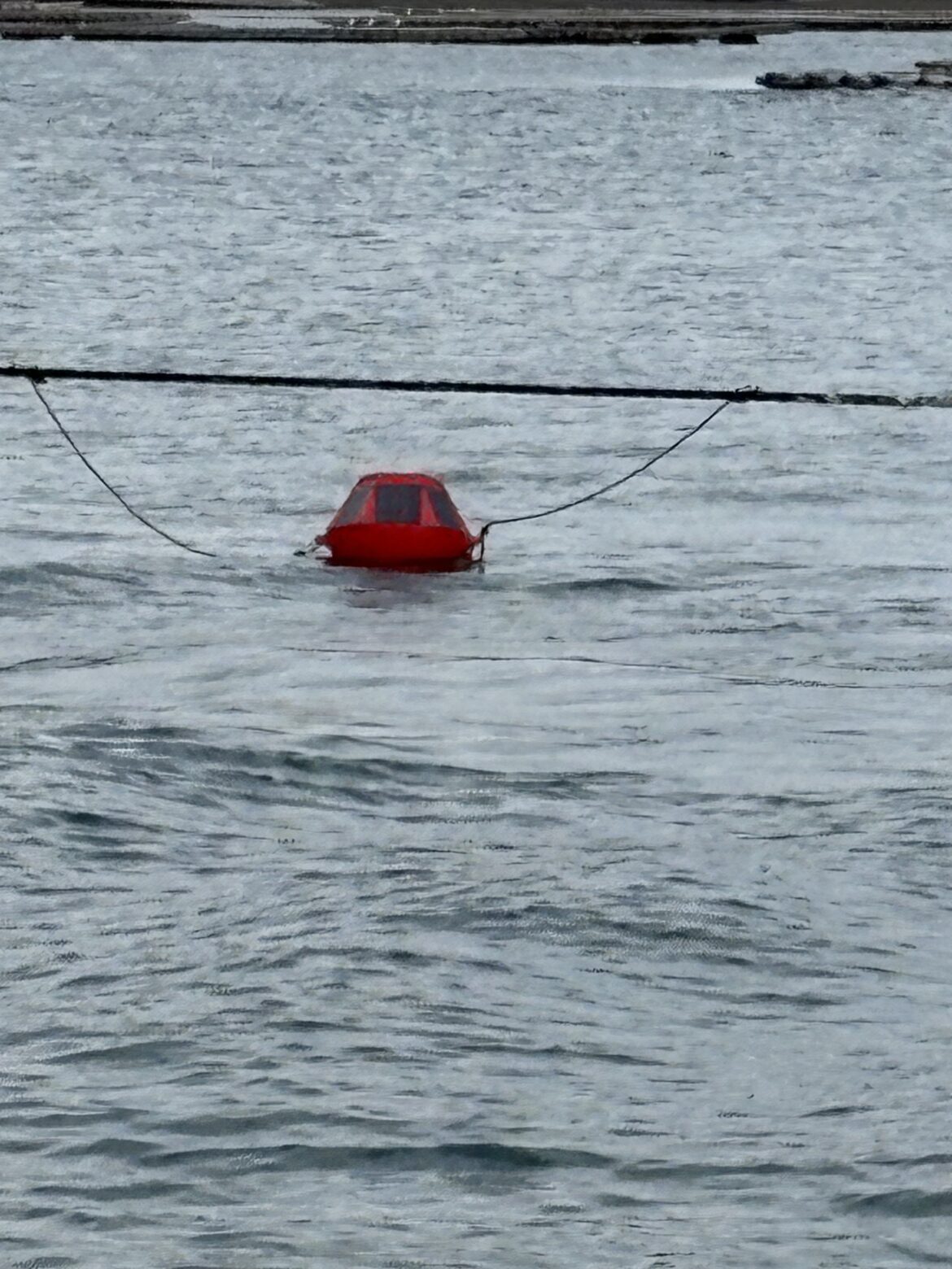
We have deployed three buoys in Mitsuguchi Bay, Yasuura, Hiroshima Prefecture, at oyster aquaculture farm sites to conduct a long-term monitoring of seawater environment.
Coastal Hazards and Energy System Science (CHESS) Lab
広島大学大学院先進理工系科学研究科 理工学融合プログラム 沿岸災害・エネルギーシステム科学研究室
We have deployed three buoys in Mitsuguchi Bay, Yasuura, Hiroshima Prefecture, at oyster aquaculture farm sites to conduct a long-term monitoring of seawater environment.
Chess buoy 1: BOB (Bob the Ocean Buoy)
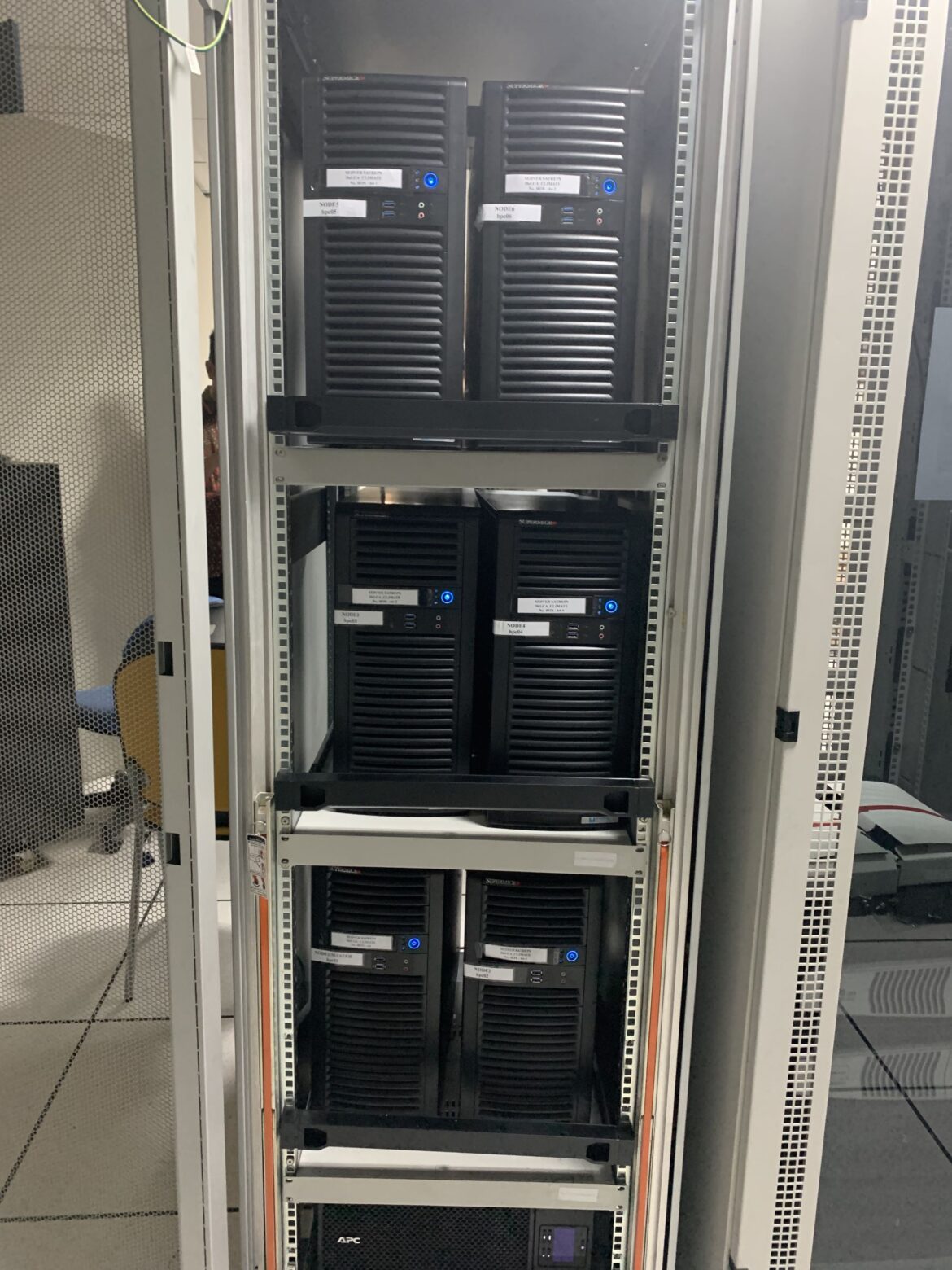
High-performance cluster (HPC) system in BMKG (national meteorological agency) of Indonesia was estblished by CHESS lab under the support by JST-JICA SATREPS project. (10 March 2023)
Open Topography for high-resolution topography data and tools https://opentopography.org/
Small amplitude solitary wave interacting with a parabolic hump Link
How to mask out a certain region below a particular water depth or above a particular elevation with GEBCO_2019.nc dataset. GEBCO_2019.nc is a global topographic and bathymetric chart with 15 arc-sec resolution which can be obtained from https://www.gebco.net/ Below is…
Read more
Example of single run of Gerris $ gerris3D -m tides.gfs | gfsview3D tides.gfv In parallel run $ gerris3D -m -s 1 tides.gfs > tidess.gfs $ gerris3D -b 4 tidess.gfs > tidesb.gfs $ mpirun -np 4 gerris3D tidesb.gfs
plot_bathy.sh for checking the bathymetry input #!/bin/sh infn=bathymetry # xyz file psfn=bathy region=156.75/210/-65/-23.75/-9500/5 gmt psxyz $infn -JQ180/15 -JZ5c -Bx5+llong -By5+llat -Bz2500+lbathymetry -B+t”3D bathymetry” -R$region -Sc0.025 -Ggray -p135/70 -W -P -V > $psfn.eps gs $psfn.eps plot_tide.sh for checking the M2 tide…
Read more
In this setup example, we used the Ubuntu 18.04 (Bionic Beaver) OS system on a dedicated workstation. Using the pre-built package In Ubuntu 18.04 system, type the followings: $ sudo apt install gerris But, the pre-built package does not include…
Read more
This is a technical note on how to build and execute FVCOM 4.3 in parallel mode using Intel compilers on CHESS lab HPC at Hiroshima University. Suppose the source code exists in fvcom43/FVCOM_source, and fvcom43/Examples/Estuary is a selected test case. Preparation for METIS…
Read more