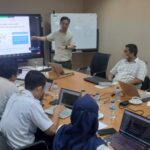
Land Use and Land Cover (LULC) workshop will be held as follows.
Date : 18th (Mon) ~ 22nd (Fri) December 2017
Venue: IDEC510
Instructor: Dr. Andhang (IDEC, HU)
The contents :
- Day 1 – Obtaining satellite imagery (Landsat 8) and its processing in ArcGIS
– Introduction to Landsat satellite imagery.
– Learn how to select the proper/good satellite imagery.
– Brief Introduction to ArcGIS’s functions for LULC processing. - Day 2 – LULC classification using ArcGIS
– By using the supervised and unsupervised classification method. - Day 3 – Preparation of the LULC input data for WRF simulation.
- Day 4 – Brief introduction to WRF.
– Preparing the geogrid data using ArcGIS and Microsoft Excel. - Day 5 – Running WRF simulation by using the created LULC input data.
– Try to run the WRF simulation by using the created geogrid.
What to prepare before the workshop.
– Try/learn how to obtain the satellite imagery of the research area from https://earthexplorer.usg
– Try/learn how to obtain the satellite imagery of the research area from https://earthexplorer.usg


